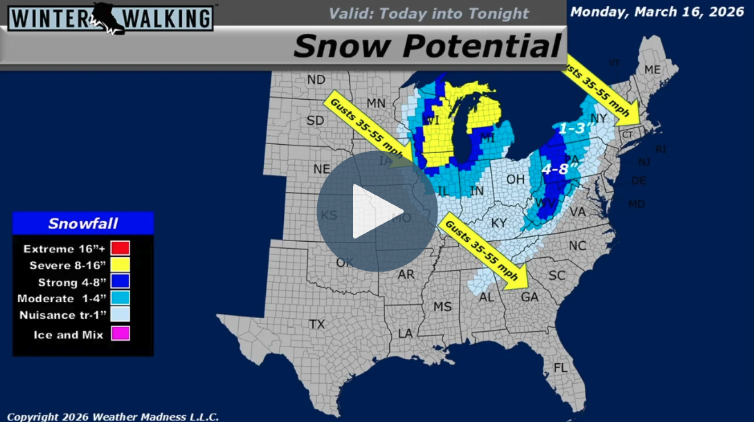
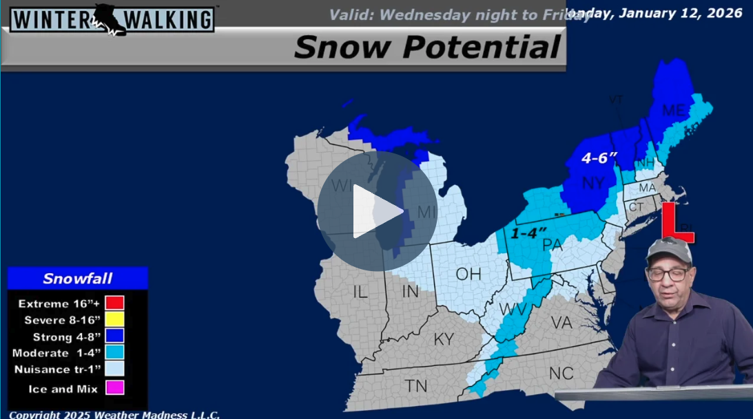
Meteorologist Henry Margusity details the aftermath of a massive blizzard that recently hammered the Midwest, dropping anywhere from 3 to 30 inches of snow in areas like Wisconsin. As this powerful system pushes up into Canada, its associated cold front is bringing a dangerous mix of severe weather today, including the potential for tornado activity. On the back side of this front, a band of snow is currently tracking through the Appalachians and up into New York and Pennsylvania, expected to leave 1 to 3 inches of accumulation. While the blizzard departs, the active pattern continues without […]
Continue Reading
Meteorologist Henry Margusity reports on a massive blizzard currently battering the Northeast, dropping up to 30 inches of snow across areas from New Jersey and New York City up through Southern New England. While this "powerhouse" storm is beginning to head out to sea, places like Maine will continue to see high winds, blowing snow, and heavy accumulation through the afternoon. Unfortunately, the relief will be incredibly short-lived, as a rapid succession of weak clippers and new storm systems are lined up right behind it. Margusity warns that the exact same areas currently being buried will[…]
Continue Reading
The 2026 winter season is proving to be one for the record books, and the upcoming Valentine's Day holiday is no exception. According to the latest weather forecast from meteorologist Henry Margusity, a significant weather system is set to transform much of the United States into a classic winter scene just in time for the weekend of February 14. This "Valentine’s Day delivery" is part of a larger, long-term weather pattern driven by a stratospheric warming event. This atmospheric phenomenon is effectively "pancaking" Arctic air southward, ensuring that cold temperatures and snowy conditions r[…]
Continue Reading
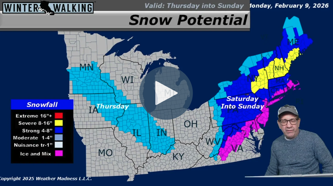
Meteorologist Henry Margusity delivers a stark update, confirming that winter has returned with a vengeance after a major storm system brought widespread snow and ice to nearly half of the country. The immediate forecast highlights a departing system still dropping snow in the Northeast, followed by lingering cold air and a series of clipper systems bringing light snow to the Great Lakes and Midwest throughout the week. A potentially significant coastal storm is also being monitored for the upcoming weekend, which could impact the Mid-Atlantic and Northeast, though forecast models currently di[…]
Continue Reading
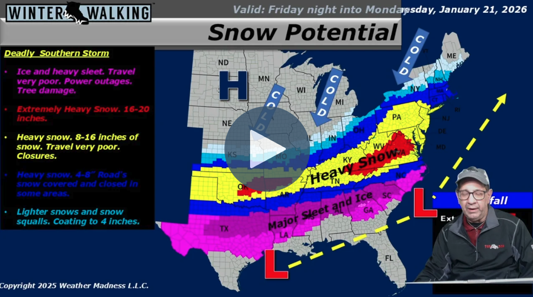
Meteorologist Henry Margusity issues a stark warning for a severe winter storm developing Friday night in the Southern Plains and tracking northeast through the weekend. While weak clipper systems are currently bringing light snow to the Midwest, a massive arctic high is pushing freezing air southward, setting the stage for a dangerous ice event across the South—including Atlanta, Shreveport, and Houston—where significant ice accumulation, power outages, and travel shutdowns are likely. As the system moves northward by Monday morning, it is expected to dump heavy snow along the I-95 corridor, […]
Continue Reading
Meteorologist Henry Margusity reports that the weather pattern remains stuck in a two-month-long cycle of weak "clipper" systems moving rapidly from Canada through the Great Lakes and into the Northeast. This relentless "conveyor belt" is bringing daily chances for snow showers and heavier squalls, including a system passing through today and another targeted for Tuesday night into Wednesday. While most areas will see only light coatings, heavier snow accumulations are expected across Upstate New York and Northern Michigan as these fast-moving disturbances continue to track east. The intensity[…]
Continue Reading

